Buying mountain land in Fairview can feel exciting right up until the practical questions start piling up. Can you actually build on it, is the access legal and usable, and will septic or slope issues change your budget? If you are looking at land in this part of Buncombe County, a little upfront homework can save you time, money, and stress. This guide walks you through the main buildability checks, permits, and due diligence steps so you can evaluate a parcel with more confidence. Let’s dive in.
Start With Jurisdiction and Zoning
In Fairview, one of the first things to confirm is who governs the parcel. For unincorporated areas of Buncombe County, the county handles items such as rezoning, variances, special use permits, and major or minor subdivisions. That matters because the review path for a property can affect both timing and what you are allowed to do.
Buncombe County GIS is a helpful first screening tool for parcel records, zoning layers, and basic lot information. Still, the county notes that GIS data comes from recorded deeds, plats, and other public records and should not be treated as the final word. If you want to verify boundaries, easements, or legal access, you will need to review the primary recorded documents.
Zoning is especially important on mountain land because some parcels may fall within overlay districts. Buncombe County notes that zoning can determine whether a parcel needs a zoning permit, including land affected by the steep slope overlay. Before you get attached to a lot, make sure you know its zoning classification and whether any overlay rules apply.
Check Access Before Anything Else
A beautiful parcel is much less useful if access is unclear or difficult to improve. In mountain settings, access questions often shape both buildability and cost. You want to know not just whether a road reaches the property, but what type of road it is and who is responsible for it.
Public or Private Road?
If a road is not clearly public, verify whether it is private, who maintains it, and whether NCDOT includes it in its maintenance system. NCDOT provides tools to look up roads, and it notes that roads not highlighted in its system may be private or municipal. That distinction matters if you are budgeting for maintenance, negotiating road agreements, or planning construction traffic.
Driveway Permit Requirements
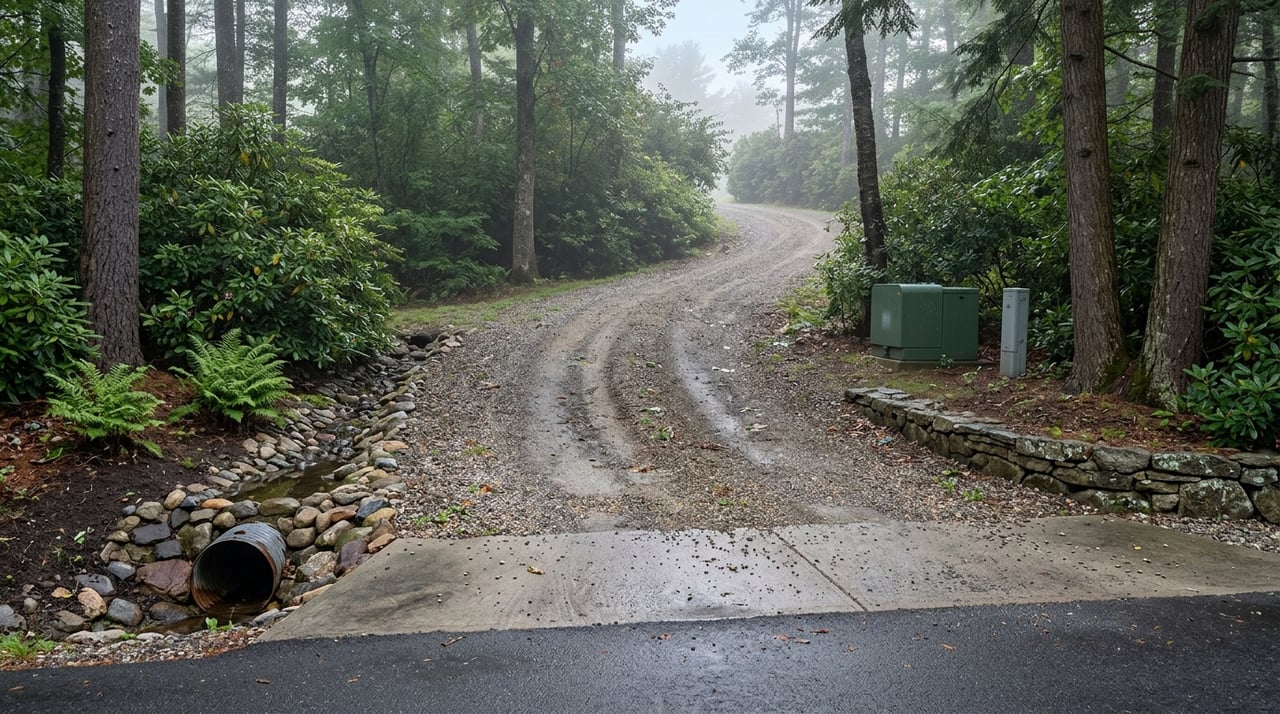
If your access point connects to the state highway system, NCDOT requires a driveway permit to obtain or modify that access. The permit process considers design, drainage, traffic impact, and safety. NCDOT also recommends early contact with the district engineer, which can help you avoid surprises later.
Subdivision Access Rules
If the parcel is part of a larger tract or a proposed split, subdivision design rules may also matter. Buncombe County says special subdivisions that create a private road, use a private driveway serving more than two lots, or create lots without direct access from a state road may require Fire Marshal approval. That is one more reason to study the access setup early instead of assuming it will work out.
Slope Can Make or Break a Deal
In Fairview and across Western North Carolina, topography is one of the biggest filters for mountain land. A parcel may look ideal online, but once you factor in slope, driveway layout, drainage, and grading, the real building area may be much smaller than you expected. This is where practical site review matters.
ReadyNC warns that landslides are more likely where people build near steep slopes, mountain edges, or drainage ways. NC DEQ also notes that landslides are most common in the mountain region and can be triggered by large rainstorms, hurricanes, freeze-thaw cycles, and human activity. In other words, slope is not just a design concern. It is also a safety and cost issue.
When Slope Triggers More Review
Buncombe County hillside development materials show how detailed the review can become on steeper sites. Hillside applications may require slope analysis, mapping of moderate and high landslide hazard areas, floodplain boundaries, wetlands, and surface waters. On some sites with slopes over 30 percent, geotechnical design may be required.
The county also notes that broader hillside review may involve global stability analysis on slopes over 35 percent or in mapped hazard areas. In addition, the steep slope/high elevation overlay applies to land at elevations of 2,500 feet or higher with natural slopes of 35 percent or greater. Even if only part of a parcel is affected, those conditions can raise engineering expectations and limit where you can build.
Septic and Well Feasibility Come Early
For many mountain parcels, utilities are the make-or-break issue. If public sewer is not available, Buncombe County requires an approved wastewater system. The county also states that a building permit will not be issued until an Authorization to Construct for the septic system has been issued.
Buncombe County Environmental Health handles permits and inspections for septic systems and private drinking water wells. The county says land should be evaluated and a perc test completed before other permits are issued. Applications require the parcel ID number and a plat, so this step is easiest when your property records are already organized.
Why an Improvement Permit Matters
If you want to evaluate a lot before closing, ask whether an Improvement Permit has already been issued or whether one can be pursued during due diligence. Buncombe County says an Improvement Permit shows that a septic system may be installed for a specified project. It is valid for at least five years and may be issued with no expiration date when supported by an engineered plat and detailed site plan.
That can be a very useful checkpoint because septic feasibility affects where you place the home, driveway, well, and drain field. On a mountain lot, those pieces must work together. A parcel that looks large on paper may still have a limited usable area once all those requirements are laid out.
Don’t Ignore Floodplain and Stormwater
Mountain buyers sometimes focus so much on ridge lines and slopes that they forget about lower areas of the property. In Fairview, creek bottoms, valleys, and road crossings can bring floodplain concerns into play. Buncombe County regulates development within the 100-year floodplain, including new structures, additions, grading, filling, and other man-made changes.
The county also notes that floodways and non-encroachment areas may require an engineered No Impact study. If a parcel includes stream frontage or low areas near a road crossing, that review may affect where you can place improvements. It is worth checking before you assume the entire tract is equally usable.
Stormwater and erosion control also matter on mountain land. Buncombe County says stormwater permits are required for residential development disturbing one acre or more. The county also requires erosion control permits for land-disturbing activity of one acre or more, or one-quarter acre or more in hillside subdivisions.
If a stormwater permit is required, county code says it must be obtained before a land-disturbing permit can be issued. The county also notes that stormwater plans must be sealed by a licensed Professional Engineer or Landscape Architect competent in stormwater hydrology and hydraulics. That can add time, design work, and cost, so it should be part of your planning from the beginning.
Build a Local Due Diligence Team
Mountain land is not the place for guesswork. Because GIS is only a screening tool and several county and state approvals may come into play, it helps to assemble a local team early. For many buyers, that means a surveyor, an environmental health specialist, a geotechnical engineer for steeper sites, and a local real estate professional or builder who understands Buncombe County permitting.
This is especially important if you are buying from out of state or trying to evaluate land remotely. A strong local team can help you spot issues that do not always show up in listing photos or basic online records. It can also help you understand whether a parcel is simply scenic or truly workable for your goals.
Smart Questions to Ask Before You Offer
Before you make an offer on mountain land in Fairview, try to answer the questions most likely to affect buildability and cost:
- Is the access public or private?
- Is the road state-maintained?
- Will a driveway permit be needed through NCDOT?
- Has septic feasibility already been determined?
- Is any part of the parcel in a floodplain?
- Does the property fall in a steep-slope overlay or mapped landslide hazard area?
- Does the lot layout support the home site, driveway, well, septic field, and stormwater area you want?
These are not minor details. They are often the difference between a parcel that is ready for planning and one that becomes more expensive or complicated than expected.
Use the County’s Pre-Development Process
If you are considering a project that involves subdivision or a more complex site plan, Buncombe County strongly recommends a pre-development conference before a preliminary plat is submitted. That conference can cover subdivision, erosion control, stormwater, zoning, flood damage prevention, and fire prevention requirements.
Even if your plan is still early, that kind of meeting can provide valuable clarity. It gives you a chance to understand the likely review path before you commit to major design or engineering costs. For mountain land, early clarity is a real advantage.
A Practical Way to Buy Fairview Land
The best approach to buying mountain land in Fairview is simple: screen first, verify second, and only then commit. Start with county GIS, zoning, and parcel records. Then confirm access, maintenance responsibility, septic feasibility, slope constraints, and floodplain or stormwater issues through the appropriate county and state channels.
That process may sound detailed, but it is what protects you. Fairview offers beautiful mountain settings and real opportunity, but the right parcel is the one that fits your budget, your build plan, and the county’s rules. If you want practical guidance as you evaluate land in Fairview or anywhere in Western North Carolina, Rebecca Lafunor can help you think through the details and connect you with the right local resources.
FAQs
What should you check first when buying mountain land in Fairview, NC?
- Start by confirming jurisdiction, zoning, parcel records, and whether Buncombe County rules apply to the property.
How do you verify road access for land in Fairview, NC?
- Check whether the road is public or private, who maintains it, and whether NCDOT includes it in its road maintenance system.
Do you need septic approval before building on land in Buncombe County?
- Yes, if public sewer is unavailable, Buncombe County requires an approved wastewater system, and a building permit will not be issued until an Authorization to Construct is issued for septic.
Why does slope matter when buying mountain land in Fairview?
- Steep slopes can affect safety, engineering requirements, driveway design, stormwater planning, and where a home can realistically be built.
Can floodplain rules affect mountain property in Fairview, NC?
- Yes, Buncombe County regulates development in the 100-year floodplain, including grading, filling, and construction in affected areas.
What professionals can help evaluate mountain land in Fairview?
- A surveyor, environmental health specialist, geotechnical engineer for steep sites, and a local real estate professional or builder familiar with Buncombe County can all be helpful early in the process.